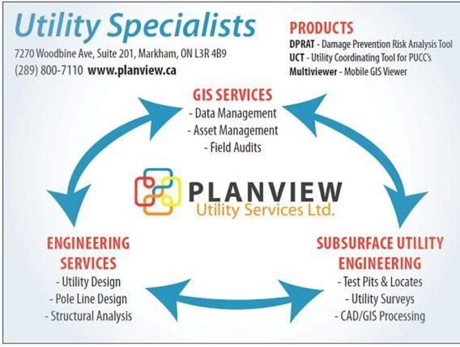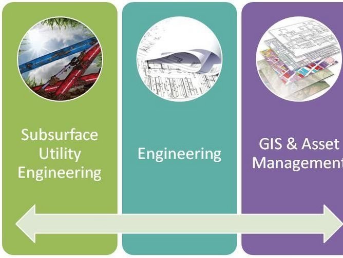
Planview Utility Services is a diverse company offering utility engineering, GIS data management services, and subsurface utility engineering. Using a synergistic approach, Planview provides utilities with value added services for each of its three areas of operation.
The company’s diverse engineering team is equipped to take on a wide range of projects and is able to see them through from concept to completion. This unique blend of services sets Planview apart from the competition. Planview is able to provide value added services throughout the asset lifecycle—from planning and design to construction and ongoing maintenance.
“We never miss an opportunity to collect data,” Director of GIS Services, Kris Philpott said. “Once an asset is exposed we collect and deliver the data back to you in GIS format. This ensures a commitment to continual data improvement and reduces risk and truck rolls all while focusing on damage prevention, employee safety and public safety.”
A Triple Threat
Planview employs this level of commitment and attention to detail across all of its diverse service areas.
“Our diverse team brings understanding to every aspect of our clients—who are mainly Utilities (Telecommunication, Electric, Gas and Water/Municipal). Our focus is to provide small firm attention to the industry and to give partner level attention to all projects,” said Bob Irwin, president of Planview Utility Services.
The company prides itself on not only its diverse service range, but also its flexibility. When it comes to project management, it’s important to Planview to not only focus on the details, but the bigger picture as well. With 90 years combined experience in its Partner Team, Planview is able to tackle projects across its three services areas as cohesive unit, utilizing its ability to manage both big and little aspects.
“A SUE project brings opportunities to a utility to improve GIS data as well as provide detailed information to complete efficient engineering design,” Philpott explained. “An engineering project ultimately leads to construction of new assets which leads to GIS updates. The cycle continues as future SUE projects are more efficient with accurate GIS data.”
Working Together
The strong relationship Planview maintains with those it works with is a key factor in its success.
“Our vision as a growing company is to continue to provide partner level attention to our clients,” Irwin said. “Our team strives to maintain strong relationships with our clients built on trust.”
One particular partner of note is Project X Ltd (www.pxltd.ca), the technology partner and provider of the GeoDash software and applications for Planview.
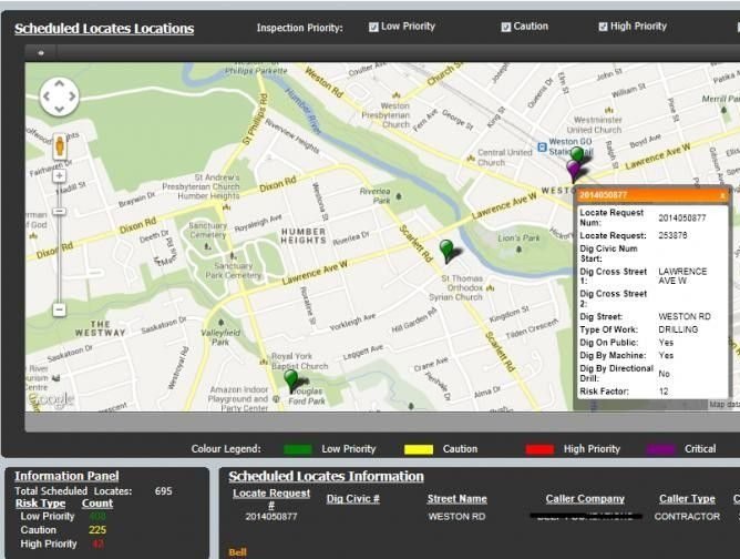
“Together with Project X Ltd, we developed a Damage Prevention solution that allows infrastructure owners to be proactive by analyzing the associated risks of each Underground Locates,” Philpott explained. “The solution is built on MicroStrategy and GeoDash. The tool is called: DPRAT—Damage Prevention Risk Analysis Tool.”
Working together with Project X Ltd we took the core knowledge and data available and coupled it with the cost effective solution of MicroStrategy to quickly reconfigure the underlying data to release the value of a highly customizable project. This enabled Plaview to monetize their data and create a new revenue stream. Philpott explained that the tool was developed for Bell Canada, Union Gas and Enbridge and currently has 80 users across the three organizations.
“We have developed a risk algorithm which analysis each Locate and assigns risk based on proximity to underground infrastructure, digging methods, depth and even who is doing the excavating,” he added. “Infrastructure owners can identify where the high risk excavating is going to occur and choose to be on-site during the excavation or complete a quality check on the Locate.”
The Power of Data
Planview also believes that companies are now seeing the value of maintaining accurate mapping and GIS data, as it helps improve operational efficiencies. Recently, at the Canadian Common Grounds Alliance, Philpott presented on how crowdsourcing and swam theory concepts can transform a utility and adopt methods used by Google Maps to have an organic GIS maintained by the entire company.
“This is a shift from the current paradigm of a single GIS or Records department that is responsible for the accuracy of mapping data,” he said. “Planview is actively working on a project, with a utility in Ontario, which is code named Mapping Utopia. This project aims to validate and improve existing GIS data and to implement the required processes to ensure the data remains valid. Working on a specific pilot area, our client hopes to measure the operational efficiencies of a near perfect GIS dataset.”
Benefits of this technology include an increased number of locate clears, which will reduce the number of truck rolls to complete field locates.
While this is something Planview will continue to work on, it also aims to improve in the more general sense as well. Using their diverse range of experience and services offered it hopes to provide support for its existing clients—all while growing a new client base.